Great Green Wall of Andhra Pradesh (GGW-AP): Coastal Bio-Shield Initiative
The Great Green Wall of Andhra Pradesh (GGW-AP) is a monumental coastal afforestation and climate resilience project spearheaded by Deputy Chief Minister Pawan Kalyan and the AP Forest Department. Designed to protect the state’s vulnerable 974 km mainland coastline from devastating cyclones, storm surges, and sea erosion, this initiative replaces reactive disaster management with a proactive, nature-based "living ecological shield."
Inspired by Africa's Great Green Wall, the AP project establishes a 5-kilometer-wide multi-layered green belt extending from Srikakulam to Tirupati. By strategically planting hypersalinity-tolerant mangroves at the intertidal vanguard, tall casuarina trees as windbreaks, and dense economic agroforestry inland, the GGW-AP aims to restore 50% of the state's green cover by 2047. Funded through a convergence of MGNREGS, CAMPA, and international climate finance, the bio-shield actively safeguards the lives and livelihoods of 3.3 million residents living in high-risk coastal red zones.
Strategic Framework & Metrics
Key data points driving the coastal bio-shield implementation.
974 km Coverage
Securing the primary mainland coast from Tirupati to Srikakulam (expanding to 1,053 km including estuarine creeks).
5km Width Belt
A multi-tier defense featuring a core dense plantation of 50–200 metres directly on the vulnerable shorelines.
3.3M Protected
Directly shields 3.3 million citizens currently residing within the highly vulnerable 5-km coastal red zone.
Convergence
Financed via MGNREGS, CAMPA, Green Credit, and global climate funds, creating vast local green jobs.
Expected Ecological & Economic ROI
Structural Zonation Matrix
The structural engineering of the GGW-AP bio-shield follows a highly specific, multi-row plantation matrix designed by the Forest Department. Rather than a random assortment of trees, the shelterbelt is calibrated using a 3-tier defense mechanism to systematically break wind velocity and trap salinity.
The Seaward Vanguard
The absolute first line of defense located directly in the intertidal zone and beach crests. Its primary mechanical goal is to absorb sheer tidal energy, trap moving sediment to halt beach loss, and block the initial assault of gale-force winds.
Deployed Species
Avicennia marina (Mangroves): Thrive in hypersalinity, their dense root systems act as physical sea-walls.
Casuarina (Australian Pine): Planted on sandy crests; their needle-like foliage filters rather than blocks wind, preventing the trees from snapping.
The Wind Ramps (Intermediate)
Positioned slightly inland along canal bunds and roadways. The aerodynamic goal of this layer is "Uplift"—forcing high-speed coastal winds up and over human settlements and agricultural tracts, while filtering out corrosive salt spray.
Deployed Species
Palmyra (Borassus flabellifer): Highly flexible, cyclone-resistant trunks.
Bamboo & Silver Oak: Tall, straight-growing species that create a rapid upward ramp for air currents.
The Economic Canopy Buffer
Extending up to 5km inland, this final zone integrates disaster resilience with local economies. It creates a dense, year-round microclimate that completely stops residual breezes while providing harvestable goods for the community.
Deployed Species
Agroforestry Evergreens: Mango, Jackfruit, and Jamun. These provide heavy, dome-shaped canopies that establish a cool, humid zone, effectively protecting inland areas from dry heat and final wind drafts.
Shelterbelt Engineering Matrix
A highly calibrated 3-to-5 row plantation strategy designed to maximize wind deflection and protect inland communities. With appropriate setbacks from roads and buildings, each row serves a specific aerodynamic and defensive purpose.
Outer Row: "The Defense"
Goal: The thorny barrier. Stops animals and breaks the initial force of ground-level dust and wind.
- • Karonda (Carissa carandas): Dense, thorny shrub; highly drought-tolerant.
- • Bougainvillea: Thick thorny mesh blocks ground wind.
- • Mehndi (Henna): Hardy bush that filters low-level dust.
Middle Row: "The Uplift"
Goal: The wind ramp. Tall, straight-growing species to "lift" the wind over inland fields and homes.
- • Casuarina (Savukku): The #1 choice for coastal windbreaks.
- • Silver Oak (Grevillea robusta): Grows straight and tall quickly, lifting wind effectively.
- • Bamboo: Flexible wall that bends with the wind and pushes air currents upward.
Inner Row: "The Shield"
Goal: The year-round canopy. Creates a cool micro-climate and stops remaining breeze.
- • Mango (Mangifera indica): Dense, dome-shaped canopy blocks 100% of wind.
- • Jackfruit (Artocarpus heterophyllus): Thick, leathery leaves impenetrable to drafts.
- • Jamun (Syzygium cumini): Creates a cool, humid zone beneath.
The Biological Arsenal
Deep-dive into the specific flora utilized to construct the wall.
Mangroves (Avicennia marina)
The ultimate coastal shock absorber. Studies indicate mature mangrove belts can reduce tsunami wave heights by up to 60%.
- Prevents severe coastal erosion.
- Acts as critical marine nursery.
Casuarina (Australian Pine)
Fast-growing, tall barriers planted on sandy shores. Their unique foliage whistles in the wind rather than snapping under pressure.
- Stabilizes loose sand dunes.
- Blocks highly saline winds.
Palmyra (Toddy Palm)
The state tree of AP. Incredibly resilient to hurricane-force winds due to its highly flexible trunk structure.
- Deep roots bind soil securely.
- High economic value for locals.
Bamboo (Bambusoideae)
Planted along riverbanks and canals within the bio-shield. Dense clumps effectively break flood water velocity.
- Rapid regeneration rate.
- Vastly improves water infiltration.
A History of Fury: Why the Wall is Necessary
A timeline of the devastating cyclones driving the urgency of the GGW-AP mandate.
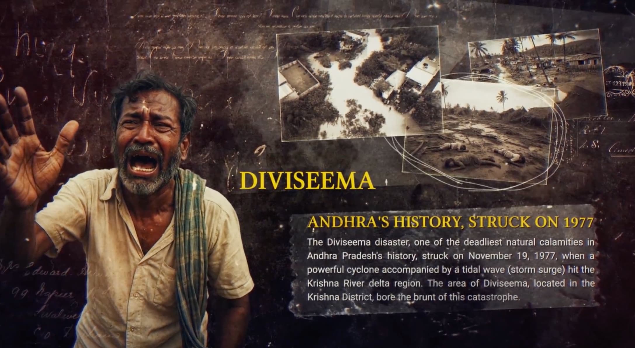
1977: Diviseema Cyclone
November 19, 1977One of the deadliest natural calamities in AP's history. A massive tidal wave and storm surge wiped out the Krishna River delta region, permanently altering the landscape.
1980: Machilipatnam Cyclone
1980A significant cyclonic event that further highlighted the extreme vulnerability of the Krishna district coastline to recurring oceanic storms.

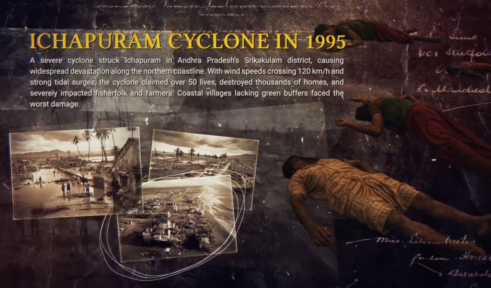
1995: Ichapuram Cyclone
1995A severe cyclone struck Srikakulam district, causing widespread devastation. With wind speeds crossing 120 km/h, the cyclone claimed over 50 lives and destroyed thousands of homes in coastal villages lacking green buffers.
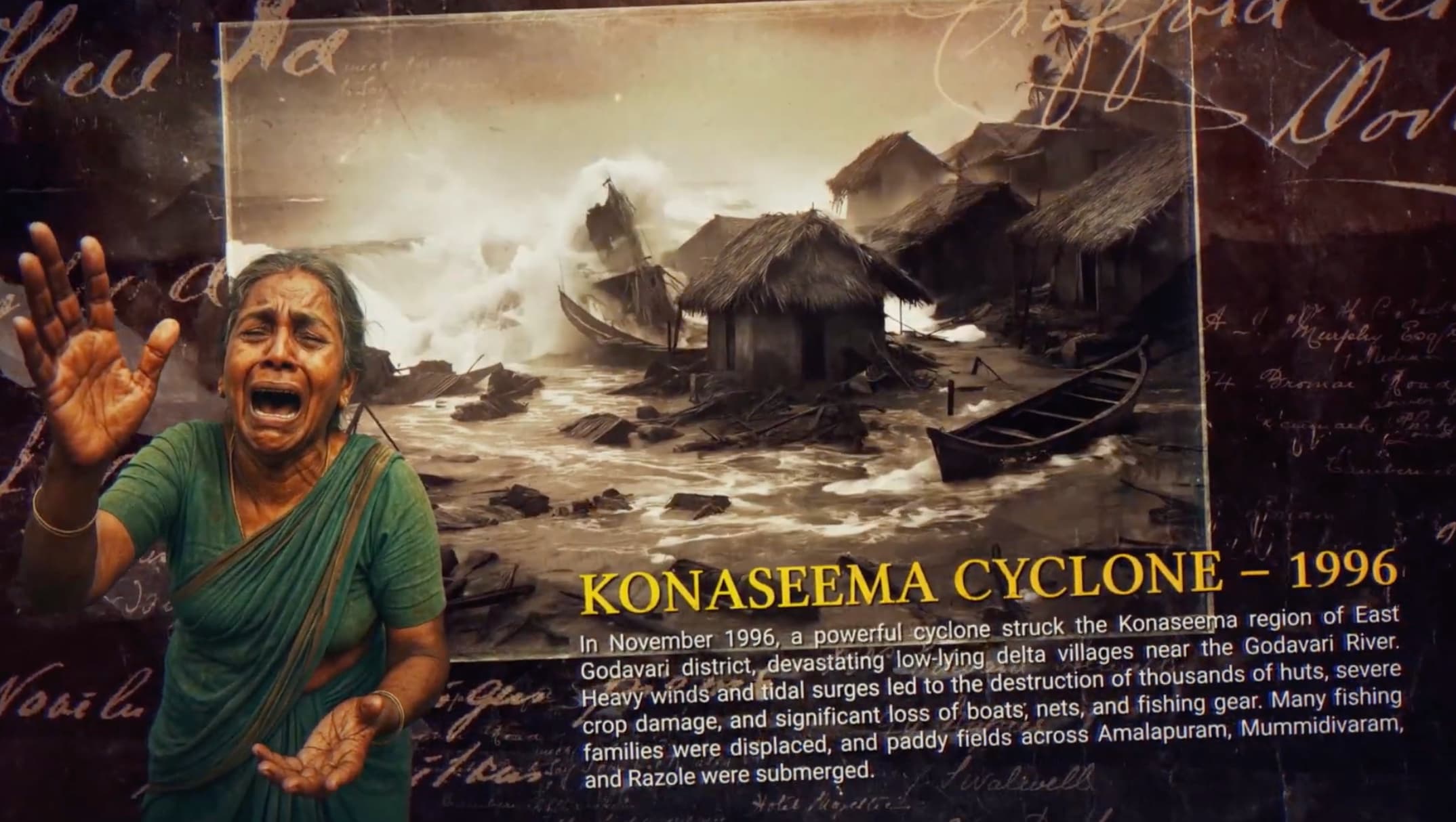
1996: Konaseema Cyclone
November 6, 1996Devastated low-lying delta villages near the Godavari River. Heavy winds and tidal surges destroyed thousands of homes and submerged vast tracts of agricultural paddy fields.
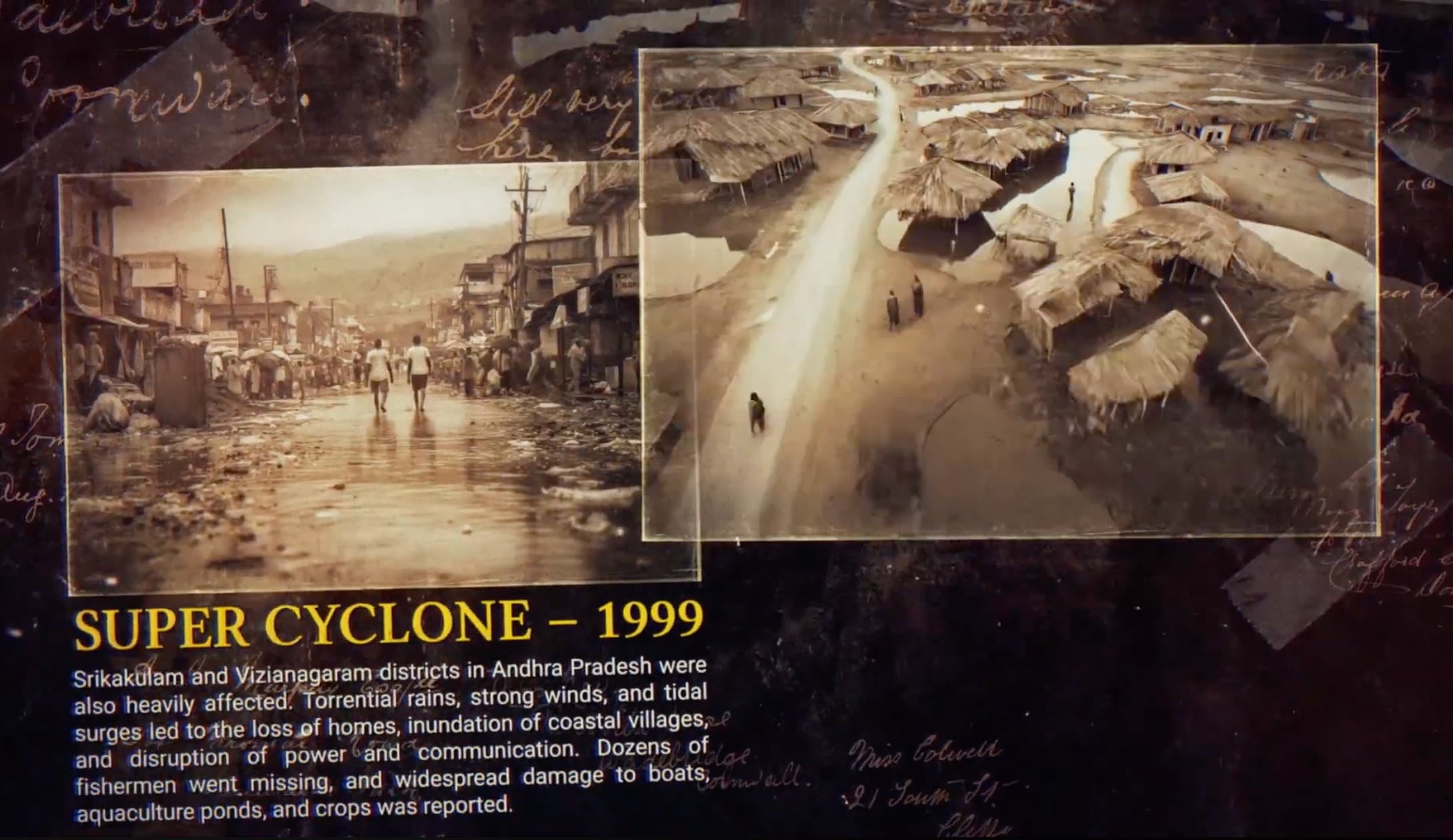
1999: Super Cyclone
1999Srikakulam and Vizianagaram were heavily affected. Torrential rains and tidal surges led to the inundation of coastal villages. Widespread damage to boats, aquaculture ponds, and crops was reported.
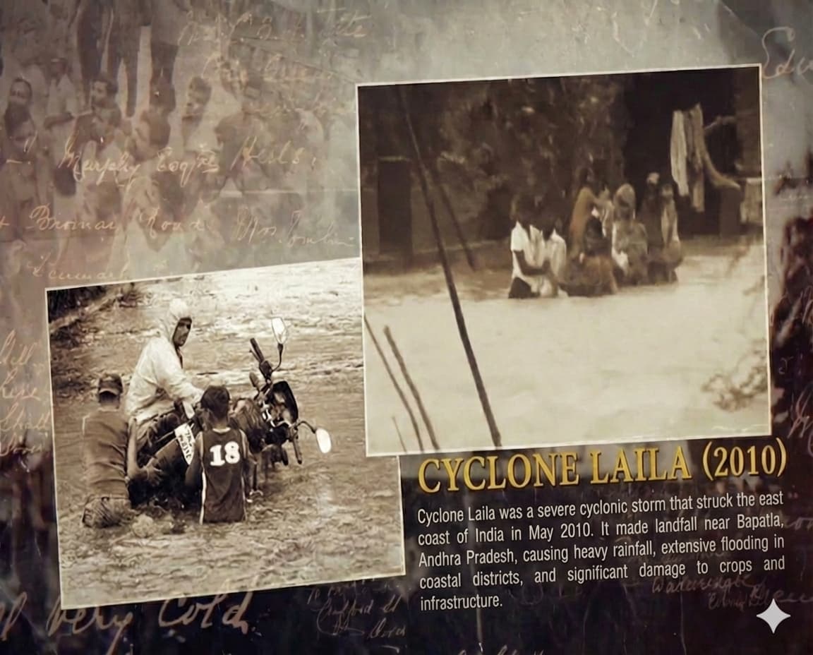
2010: Cyclone Laila
May 20, 2010The first severe cyclonic storm to hit AP in over a decade, making landfall near Bapatla. Packing winds of over 100 km/h, it caused significant flooding across Krishna, Guntur, and East Godavari districts.
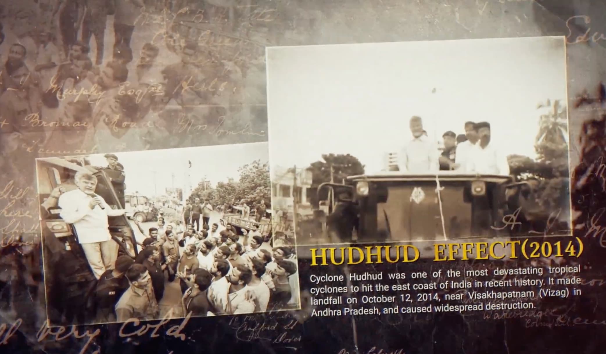
2014: Cyclone Hudhud
October 12, 2014A catastrophic tropical cyclone that made direct landfall near Visakhapatnam (Vizag), causing unprecedented urban and infrastructure destruction across the coast.
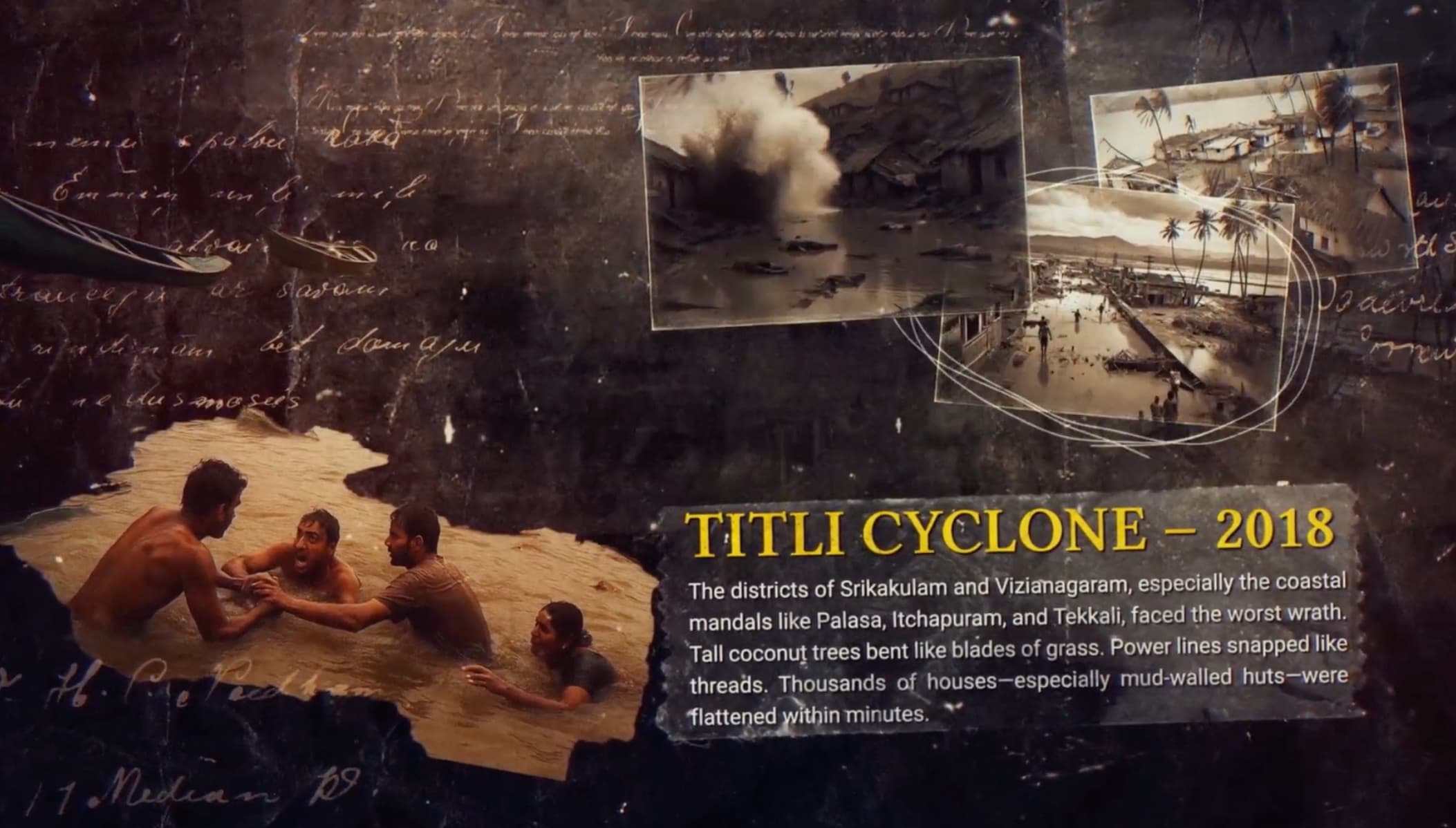
2018: Cyclone Titli
October 11, 2018Srikakulam and Vizianagaram faced the worst wrath. Tall coconut trees bent like blades of grass, and thousands of houses—especially mud-walled huts—were flattened within minutes.
2023: Cyclone Michaung
December 2023Triggered severe flooding in Bapatla. It violently exposed the ongoing issue of coastal erosion, directly accelerating the governmental push for the GGW-AP initiative.

Global Context: Africa's Great Green Wall
The GGW-AP explicitly draws inspiration from the Great Green Wall of the Sahel. Launched in 2007 by the African Union, the African initiative aims to restore 100 million hectares of degraded land to combat desertification.
While the African wall fights the southward expansion of the Sahara Desert (Sand), the Andhra Pradesh wall fights the landward intrusion of the Bay of Bengal (Ocean/Salt). Both share the modern ecological philosophy of a "Mosaic" landscape—building integrated life systems rather than just planting uniform trees.